Of all places, why did I pick Egypt to end up last month? When I arrived into Sharm el Sheik on the 28th things weren't too bad but still ...
Why is it that everytime Tony takes us somewhere it's frozen? He has us hauling little more than pig slop in old crates into frozen and in-hospitable places and then blames me for calling in his "assignment." WHAT IS UP? (What's more, in July 2009 when we WERE actually hauling Pig Slop in Old Crates, Tony didn't even do that one!)
I didn't waste time getting out of the political hotbed of the Middle East. At dawn on 01-March I flew the Flight Club's VC-10 to London/Stansted. (pict1) (pict2) As quickly as possible I switched into the Flight Club's DC-8 stretch (pict3) and flew across the pond to Minneapolis/St. Paul (pict4) and again quickly switched planes. The final leg into Yellowknife flown in the Flight Club's CRJ-900 with arrival the night of 01-March. (pict5) (pict6) I've flown to/from Yellowknife in older sim versions but never in FSX; we'll see how the Frozen Tundra of the Northwest Territories looks in this sim - and I'll be anxious to check out some of the other local airstrips around these parts.
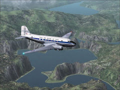
Tony indicated that I may have to make several trips depending on how much cargo I was hauling. While I totally love the Lockheed Electra (see my PIREP from February 2008) I don't have one installed in FSX so I picked the Flight Club's DC-7 instead. At dawn on 02-March I was ready to head out ...
I dowloaded real weather which was pretty calm at Yellowknife and departed to the south. (pict7) I climbed to 4,000 feet and picked up my 125-mile route up to CYRA. There wasn't alot to see but I had about 20 minutes of lightning and turbulence along the way. (pict8) I made a straight-in approach to Rae Lakes (pict9) setting the mains down RIGHT on the marker lights (100 knots IAS) (pict10) (pict11) and sliding to a stop with my nose wheel JUST off the far end - I hope 3,000 feet is the shortest runway! I taxied over to the parking area but didn't shut down. I used every inch of runway on departure (pict12)and, in fact, sank just a bit after barely clearing the fence!
Next it was 170 miles to CYWJ. (pict13) This leg was windy and therefore bumpy but with looking at an extra 900 feet to land and get stopped I was happy! (pict14) (pict15) (pict16) (pict17)
Next we were looking at 147 some-odd miles to CYIX. (pict18) (pict19) Skies had been progressively clearing since the first leg and during the first, over-water portion of the flight I looked up information and found a 5,00-foot runway was waiting for us there! Less than fully-loaded 737s do okay with runways around 5,000 feet but as I guy who got into flightsim in order to fly commercial jets, I normally expected to find myself flying in areas a bit more ... populated. (pict20) (pict21) (pict22)
Each leg seemed to be getting longer - now we had nearly 200 miles to CYOA, a runway over 6,000 feet long! (pict23) (pict24)
From here I was pretty much done smelling like rotting fish (See Tony's March 2003 FOTM when we had to haul rotting fish around a frozen southern Alaska!) I loaded up the http://www.plr.org "Positive Life Radio" CRJ-200 (pict25)(pict26) and flew southwest to warmer and much more scenic climates of Victoria, BC. (pict27) (pict28) (pict29) I invited the family to come on up and join me and we spent the next 4 weeks RELAXING right here on Vancouver Island.
P.S. If anyone tried to reach me, sorry, the phone was off!
Too Much FS

Our Current, Newer Logo
Too Much FS

Our Original Logo
About Me

- Flounder
- I am a computer flight simulator enthusiast, a "Flight Simmer." "Simmers" use a flight simulation "game" such as Microsoft's Flight Simulator and pretend to fly various aircraft. The "game" is quite realistic actually, it includes cockpit procedures and real-world navigation as well as scenery and more than 24,000 airports covering the entire planet. For some users this is only a game, for a few it seems this is their life and for the rest of us, it's a HOBBY - and a great way to meet fellow aviation nuts. I along with a group of simming friends from around the globe host a virtual flying challenge each month at: www.toomuchfs.com. Please feel free to e-mail me for more information about our flight club or monthly feature flights on: www.toomuchfs.com
New Zealand's South Island
Caribbean Tours

Stormy Departure

Night Approach

South of Mumbai, India

Los Roques, Venezuela

Flight Club Airways is hosted on YahooGroups
Departing Phuket

Mumbai to Beirut

Rio, Brazil

Hazy Finals in Peru

Zurich back to Mumbai

Hot Rod out of Arequipa

Race to the runway!


