Flight Info:
This is a two-leg, regional flight from my own “neck of the woods.” These flights are occurring every day, mainly for Business travelers. These flights are flown by Horizon Air - part of Alaska Airlines, using the Dash 8 series. I will give you my route info which is at least close to what I see overhead each day and also very close to the route I took a few weeks ago when I had to fly south for a business trip. We are using the weather as it was on the morning of December 23, 2002.
Aircraft Used:
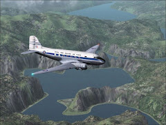
Dash8 Q-400
Departure One Info:
Departing from Medford, Oregon, Rouge Valley International Airport (KMFR). I selected runway 14 for departure. I recommend push back at 06:30 AM on a late December morning.
Weather for leg one:
Clouds = 6/8 coverage from 500 to 2,000 ft.
Winds = None.
Visibility = Under 2,500 ft 1 mile; Above 2,500 ft unlimited.
Temps = Daytime high 49°, Day/Night Variation 20°.
Flight One Info:
After departure and clearance from runway 14 I made a left-hand turn to intercept the Eugene (EUG) VOR 112.90. (Heading 354 or so) At EUG I turned to heading 356° on the V23 Airway. I followed V23 picking up the Battleground VOR (BTG) 116.60. Continue heading 356° until DME 20 miles. (My flightplan showed this as the OSWEG Intersection). Turn left toward the Hillsboro (HI) NDB 306 (which is roughly 293°) and intercept the 034° Radial to BTG. I was a bit early and the sun hadn’t yet peaked around Mt. Hood. Since I know the area well I cut the turn before HI, turning toward BTG, dropping to 3,500 ft and heading into the ILS) Intercept the ILS into runway 10R and, Happy Landings.
 356° until DME 20 miles. (My flightplan showed this as the OSWEG Intersection). Turn left toward the Hillsboro (HI) NDB 306 (which is roughly 293°) and intercept the 034° Radial to BTG. I was a bit early and the sun hadn’t yet peaked around Mt. Hood. Since I know the area well I cut the turn before HI, turning toward BTG, dropping to 3,500 ft and heading into the ILS) Intercept the ILS into runway 10R and, Happy Landings.
 Departure Two Info:
Pushback at 08:15 AM and depart KPDX from runway 10R.
Weather for leg two:
Clouds = 2/8 coverage from 1,500 to 3,000 ft.
Winds = 0, gusts 050° to 3 mph.
Visibility = Under 1,000 ft 3 miles; Above 1,000 ft unlimited.
Temps = Daytime high 45°, Day/Night Variation 20°.
Flight Two Info:
Fly east to the OGUAJ Intersection which is the 054° radial into the Klickitat (LTJ) VOR 112.30. LTJ to PDT VOR (114.70) is heading 070°, ‘bout 91 miles. There is some restricted airspace over Boardman and Umatilla. If you want to go around that you’ll do the following: From LTJ turn to 080° on Airway V112. Continue on 080° heading until you can intercept the 054° radial into Pendleton (PDT). Intercept at or about DME 29 miles. Follow 054° into PDT which leaves you a 20° turn to final.
My chart shows 3,500 ft at 10 miles DME. Cross VOR at 2,700 ft. and runway 7 threshold is 3.6 miles from the VOR with a runway heading of 074°.
Good Luck and Thank You for flying!